
What Is the Manaslu Conservation Area?
The Manaslu Conservation Area is a remote protected region in the northern part of Gorkha District, Nepal. It covers 1,663 sq. km of forested hills, river gorges, glacial valleys and high mountains. Its elevation ranges from about 600 m at the lower edge to 8,163 m at the summit of Mount Manaslu, the world’s eighth-highest peak.
Anyone doing the Manaslu Circuit Trek walks through this conservation area, so it helps to understand what it is and how it works. Between 7,000 and 9,000 people live here, many in villages shaped by Gurung and Tibetan culture. The area shelters musk deer, Himalayan tahr and snow leopards, and over 2,000 plant species have been recorded.
Manaslu Conservation Area at a Glance
| Category | Details |
| Location | Northern Gorkha District, Gandaki Province, Nepal |
| Headquarters | Prok |
| Established | 28 December 1998 |
| Area | 1,663 km² (642 sq mi) |
| Elevation range | 600 m to 8,163 m (1,970 ft to 26,781 ft) |
| Highest point | Mount Manaslu, 8,163 m |
| Main entrance | Jagat |
| Managing body | National Trust for Nature Conservation (NTNC), through the Manaslu Conservation Area Project (MCAP) |
| Population | Roughly 7,000 to 9,000 |
| Wildlife recorded | 39 mammals, 201 birds, 3 reptiles, 11 butterflies |
| Vegetation | About 2,000 flowering plant species |
| Best seasons | Spring (March–May) and autumn (September–November) |
| Major attractions | Mount Manaslu, Larkya La, Tsum Valley, Tibetan-influenced villages |
| Entrance fee | NPR 3,000 (foreign nationals), NPR 1,000 (SAARC nationals), NPR 100 (Nepali citizens) |
Where Is the Manaslu Conservation Area?
The conservation area sits in northern Gorkha and takes in the whole of Chumnubri Rural Municipality. It stretches from the lower Budhi Gandaki Valley up to the peaks around Manaslu and the Larkya La pass. It has three main sub-regions:
- Nubri Valley: Samagaun, Lho and Prok lie here, closest to Mount Manaslu.
- Kutang: the central section around Bihi, including Chumchet and Chhekampar.
- Tsum Valley: east of Bihi, toward the Tibetan border.
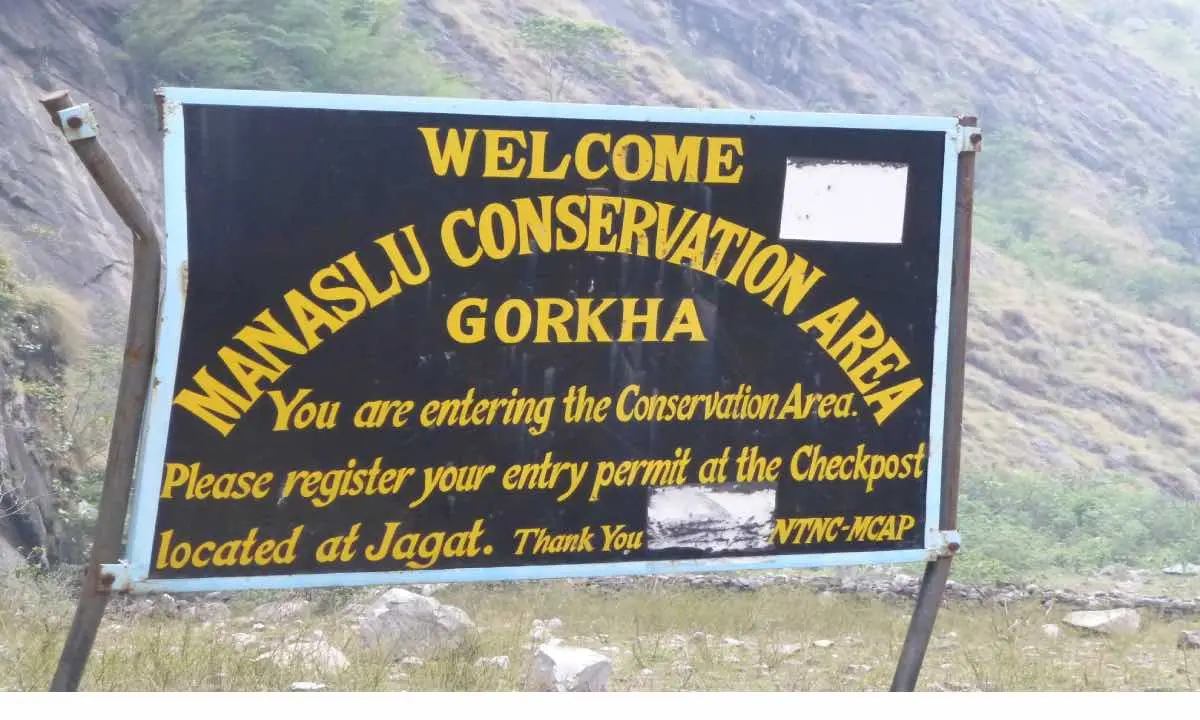
Jagat is the main gateway and the first major permit checkpoint for trekkers on the Manaslu Circuit.
Geography: What the Trail Passes Through
The area borders the Tibet Autonomous Region of China to the north and the Manang section of the Annapurna Conservation Area to the west. That makes it a landscape of shared ecosystems, wildlife habitat and old trade routes.
The Budhi Gandaki River flows through the region, and the Manaslu Circuit follows it. The trail is an old salt-trade route and covers roughly 177 km. Traders and locals used it between Tibet and the lower valleys long before trekking began.
How the Scenery Changes Along the Circuit
- Soti Khola: subtropical forest and terraced farmland.
- Towards Namrung: oak and rhododendron forest.
- Around Lho: blue pine and hemlock.
- Samagaun and Samdo: alpine meadows with patches of juniper.
- Near Larkya La: rocky, snowy terrain.
Higher up, glaciers, glacial lakes and snow peaks dominate. Birendra Lake, near Samagaun, is one of the best-known glacial lakes, and the glaciers around Manaslu and the Pungyen area add to the scenery. The landscape changes noticeably every few hundred metres of elevation gain, which is one reason the trek appeals to those who want variety as well as big mountains.
Official Map
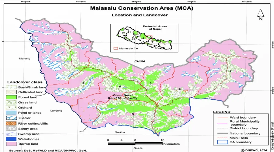
The Department of National Parks and Wildlife Conservation publishes an official map of the conservation area. It shows boundaries, main settlements, rivers and surrounding areas, and is a useful reference when planning your route.
Why Was the Conservation Area Established in 1998?
People in the Manaslu region have long depended on its forests, pastures, rivers and wildlife. As tourism grew and pressure on natural resources increased, Nepal chose to protect the region without cutting local people out of the picture. The conservation area was declared on 28 December 1998.
Under this model, communities can continue living and working inside the protected landscape and take part in managing it. The goals are to:
- protect fragile Himalayan ecosystems
- support sustainable use of natural resources
- preserve cultural heritage, including Tibetan Buddhist traditions
- sustain local livelihoods
- develop ecotourism that benefits residents
It also reflects a wider shift in Nepal’s protected-area policy, treating local people as partners in conservation.
How Is It Managed? NTNC and MCAP
The National Trust for Nature Conservation (NTNC) runs conservation and development work here through the Manaslu Conservation Area Project (MCAP). Management is not left to rangers alone. Local people are directly involved.
- 1997: NTNC began work in the region through the Manaslu Ecotourism Development Project, supported by the Government of Nepal and the Asian Development Bank.
- After 1998: NTNC introduced the Integrated Conservation and Development Program (ICDP), focused on sustainable resource management and community participation.
- Ongoing: Local groups take part in forest management, anti-poaching, conservation awareness and community development. MCAP also supports conservation education and biodiversity research and monitoring covering wildlife, plants and socio-economic conditions.
Human–wildlife conflict remains a concern, especially snow leopard attacks on livestock. In 2025, NTNC and the Nature and Biodiversity Conservation Union (NABU) began a joint effort across the Central Snow Leopard Conservation Landscape, covering both Manaslu and Annapurna. It focuses on reducing conflict, involving communities, monitoring wildlife and supporting sustainable tourism.
Manaslu Circuit Trek: Quick Answers
1) Where does the Manaslu Circuit Trek start its conservation area section?
At Jagat, the main entrance and first major permit checkpoint.
2) How long is the Manaslu Circuit?
Roughly 177 km along the Budhi Gandaki valley.
3) What is the entrance fee?
NPR 3,000 for foreign nationals, NPR 1,000 for SAARC nationals and NPR 100 for Nepali citizens.
4) When is the best time to trek?
Spring (March–May) and autumn (September–November).
5) What wildlife lives here?
Records include 39 mammals (such as musk deer, Himalayan tahr and snow leopard), 201 birds, 3 reptiles and 11 butterflies.
6) Who manages the area?
NTNC, through the Manaslu Conservation Area Project (MCAP).
Biodiversity Along the Manaslu Circuit Trek
The Manaslu Circuit Trek is known for big mountains, but the trail also passes through some of the richest habitat in the Nepal Himalaya. Forests, alpine meadows and high rocky slopes each support their own mix of animals and plants.
The reason is the drop in elevation across a short distance. Within less than 50 km, the landscape moves from subtropical river valleys to bare alpine rock. That compression of habitats gives the Manaslu Conservation Area more biodiversity than its size would suggest.
Mammals
Different species occupy different elevation bands:
- Lower and mid-elevation forests: musk deer and Himalayan black bear
- Alpine zone: blue sheep, Himalayan tahr and Himalayan marmot
- High mountain terrain: the snow leopard
- Across the area, in smaller numbers: lynx, red fox and jackal
Birds
Birdlife runs from lowland forest up to the snow line, with 110 species recorded in this source. Species to watch for as you climb include:
- Himalayan monal (Nepal’s national bird)
- Snow partridge
- Tibetan snowcock
- Golden eagle
Reptiles and Butterflies
The conservation area also supports 3 reptile species and 11 butterfly species.
Flora
More than 2,000 plant species grow across 11 forest types, and the vegetation shifts clearly as you gain height:
- Lower and mid elevations: dense forest across valleys and slopes
- Higher up: alpine meadows and more open ground
- Highest zones: sparse growth on rocky slopes and snowfields
Medicinal plants such as jatamansi also grow here and have traditionally been used by local communities. Their collection is regulated through MCAP, not open to anyone.
Snow Leopards on the Manaslu Circuit: What to Realistically Expect
Can you see a snow leopard on the Manaslu Circuit Trek? It is possible, but very unlikely. Snow leopards live in the high alpine zone above roughly 3,500 m, on rocky slopes and in quiet valleys near Samdo, Nubri and the approach to Larkya La. You can spend several days in prime habitat and see only a pugmark or a scrape on the ground.
A survey of the conservation area recorded 15 snow leopards in the Tsum and Nubri valleys: 13 adults and 2 cubs. Their main wild prey is blue sheep and Himalayan tahr, supplemented by marmots and woolly hares.
Conservation and Coexistence
Protecting snow leopards here also means helping villagers live alongside them, because livestock losses are the main source of conflict. Through MCAP, NTNC works on:
- community awareness
- conflict mitigation
- wildlife research and monitoring
- better livestock protection and compensation schemes
Manaslu is part of Nepal’s expanded Central Snow Leopard Conservation Landscape, which also includes the neighbouring Annapurna region. A 2025 national assessment estimated Nepal’s snow leopard population at 397, which shows why habitat protection matters.
You don’t need a sighting to know you are in snow leopard country. The high slopes near Samdo and the route to Larkya La are part of their range. If you do spot one, you were very lucky.
People and Culture: Nubri, Tsum and Tibetan Influence
Around 9,000 people live in the Manaslu Conservation Area, including Brahmin, Gurung, Nubri, Tsum, Tibetan/Bhote and Lama communities. Their way of life has been shaped by high-altitude farming, livestock herding, trade and Tibetan Buddhism.
Tibetan influence becomes stronger the further north you walk. In Nubri and Tsum especially, you’ll see stone-built villages, monasteries, prayer flags, prayer wheels and mani walls.
Tsum Valley: The “Hidden Sacred Valley”
Tsum Valley was closed to outsiders for generations and was officially opened to trekkers in 2008. It is still regarded as a beyul, a hidden sacred valley, and remains spiritually important to local people.
Key sites include:
- Mu Gompa (about 3,705 m): the highest monastery in Tsum
- Rachen Gompa: home to a community of Buddhist nuns
- Gumba Lungdang: set beneath the Ganesh Himal range, combining a remote spiritual setting with strong mountain views
Tsum is also known for Shyagya, a community-based tradition of non-violence that restricts hunting and killing animals. It still plays a real part in the valley’s cultural life.
Need Help? / Call Us
+977-9845548583 or Chat with us on WhatsApp
Ask a Question?
Nubri Valley: Life Beneath the High Peaks
Tibetan Buddhist culture is just as strong in the northern villages of Nubri. Around Samagaun and Samdo you’ll find stone houses, monasteries, fields and yak pastures, with the mountains as a backdrop.
Traditional livelihoods rely on a short list of crops (barley, buckwheat and potatoes) and on livestock. Yaks provide transport, food and other resources, which matters where farming is only possible for part of the year.
Samdo, close to the Tibetan border, shows the region’s historic links with Tibet. Trade and cultural exchange have shaped the architecture, language, food and religious practice on both sides.
Culture Along the Trail
You don’t need a side trip to see Manaslu’s culture. It sits right beside the path:
- mani walls carved with Buddhist prayers
- prayer flags
- chortens
- prayer wheels, including one memorable stretch with 108 prayer wheels
Etiquette tip: Walk clockwise around Buddhist monuments, keeping them on your right.
Tourism now provides income through teahouses, lodges, guiding and other trekking work. Many families still farm, keep livestock and move between higher and lower elevations with the seasons. This living culture is a big part of what sets the Manaslu Circuit Trek apart from a purely scenic walk.
Quick Answers
1) What wildlife can I see on the Manaslu Circuit Trek?
Blue sheep, Himalayan tahr, marmots and birds such as the Himalayan monal are the most realistic sightings. Snow leopards live here but are rarely seen.
2) Where is snow leopard habitat on the circuit?
Above about 3,500 m, around Samdo, Nubri and the route toward Larkya La.
3) How many snow leopards were recorded in Manaslu?
A survey recorded 15 (13 adults, 2 cubs) in the Tsum and Nubri valleys.
4) When did Tsum Valley open to trekkers?
In 2008.
5) Which way should I walk around mani walls and chortens?
Clockwise, keeping them on your right.
Villages Along the Manaslu Circuit Trek
The villages on the Manaslu Circuit Trek change noticeably as you gain altitude. In the lower section, the Budhi Gandaki flows through greener valleys with forested slopes and steep cliffs. Higher up, the landscape opens out and becomes more rugged, and stone houses, prayer flags, mani walls and Tibetan Buddhist traditions become part of daily village life.
Quick Reference: Village Elevations
| Village | Approx. elevation | Role on the trail |
| Jagat | 1,340 m | Entry to the remote section |
| Deng | 1,860 m | Overnight stop toward Upper Manaslu |
| Namrung | 2,630 m | Tibetan influence becomes clear |
| Lho | 3,180 m | Scenic village beneath high peaks |
| Shyala | 3,500 m | Open valley with views of Manaslu and Himalchuli |
| Samagaun | 3,530 m | Acclimatization stop, base for side trips |
| Samdo | 3,875 m | Last major village before Larkya La |
Jagat (about 1,340 m)
Jagat is one of the first significant settlements inside the Manaslu Conservation Area and sits beside the Budhi Gandaki River. It marks the start of the more remote part of the trek. Beyond it, the trail passes through forested slopes, waterfalls, suspension bridges and narrow sections of the river valley.
Philim
The trail climbs from Jagat to Philim, a larger Gurung settlement surrounded by terraced fields with wide views across the valley. It is one of the more substantial villages on the lower route. After Philim, the valley narrows and the trail goes deeper into gorge country.
Deng (about 1,860 m)
Deng is an important overnight stop for trekkers heading toward Upper Manaslu. The surroundings feel more enclosed, with forest, cliffs and the river dominating the approach. The valley begins to open up again beyond the village.
Nyak and Bihi
Between Deng and Namrung, the smaller settlements of Nyak and Bihi sit among wooded hillsides above the river. They offer a quieter look at local life before Tibetan cultural influence becomes more visible. They see fewer trekkers than the bigger stops, which is a large part of their appeal.
Namrung (about 2,630 m)
Namrung is where many trekkers first notice a clear shift in the character of the trail. Stone houses, Buddhist monuments, prayer flags and mani walls become more common, and the surrounding mountains feel closer as you move into the high country.
Lho (about 3,180 m)
Lho is one of the most scenic villages in upper Manaslu. It sits beneath towering peaks, with traditional stone houses and Buddhist statues nearby.
Shyala (about 3,500 m)
After the tighter sections of the trail, Shyala opens into a broad mountain valley with clear views of Manaslu, Himalchuli and neighbouring peaks. The open setting and mountain backdrop have made it one of the most photographed villages on the circuit.
Samagaun (3,530 m)
Samagaun is one of the main settlements in upper Manaslu and an important acclimatization stop. It is also the starting point for side trips to Birendra Lake and Manaslu Base Camp. Its buildings, monasteries and traditions reflect the long-established culture of the Nubri Valley.
Samdo (about 3,875 m)
Samdo is the last major village before the trail turns toward Dharmasala and the Larkya La Pass. It lies close to the Tibetan border, and Tibetan influence shows in its architecture and way of life. The setting of barren slopes and high peaks is quite different from the greener villages lower down.
Chhekampar, Nile and Chule (Tsum Valley)
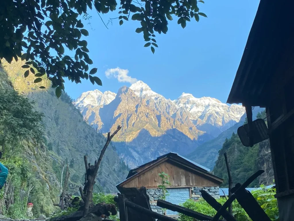
These three villages are in Tsum Valley. The valley has a distinct cultural identity, with old stone houses and long-standing Buddhist practices. That makes the Tsum Valley detour especially worthwhile for trekkers interested in the communities and traditions of the conservation area.
Trekking Routes Inside the Manaslu Conservation Area
The conservation area has several route options, from the well-established Manaslu Circuit to the quieter trails of Tsum Valley and Rupina La. Each gives a different experience of the region.
Manaslu Circuit Trek
The Manaslu Circuit Trek is the most popular route in the region.
- Start: Machha Khola
- Conservation area entry: Jagat
- Route: Budhi Gandaki Valley through Deng, Namrung, Lho, Shyala, Samagaun and Samdo
- High point: Larkya La Pass (5,106 m)
- Finish: descent via Bimthang to Dharapani, where the trail joins the Annapurna Conservation Area
The trail passes through the Nubri Valley, where Tibetan Buddhist culture, traditional villages, monasteries and mountain scenery shape the experience. Accommodation is mainly in local teahouses with simple rooms and a mix of Nepali and Tibetan-influenced food. Because it ends in the Annapurna Conservation Area, the circuit links two major conservation areas.
For planning, see the 12-day Manaslu Circuit Trek itinerary and the Manaslu & Tsum Valley Trek Itinerary.
Tsum Valley Trek
This trek focuses on one of the most culturally distinctive valleys in the conservation area. Tsum, often called a hidden valley, is known for traditional villages, ancient monasteries and strong Tibetan Buddhist heritage. The route passes peaceful mountain villages and leads to Mu Gompa at about 3,700 m.
It suits trekkers who want to focus on local life rather than crossing a high pass.
Rupina La Trek
Rupina La is an off-the-beaten-path route through one of the less commercial parts of the Manaslu region. It climbs through villages, forests and high alpine terrain to Rupina La Pass (4,720 m), with views of the Manaslu and Annapurna ranges.
There are fewer trekkers and the setting is more remote than on the classic circuit. It is recommended for experienced trekkers only, as the terrain is challenging, includes high-altitude sections and demands good fitness.
Manaslu Circuit Trek with Serang Gompa Stay
Visit View Nepal Treks also offers a 16-day Manaslu Circuit Trek with a stay at Serang Gompa. The itinerary includes a trek to this remote monastery, giving a calmer, more Buddhist side of the region before you join the main route. From there it continues through the upper villages toward Larkya La, combining the classic circuit highlights with an extra cultural experience.
Quick Answers
1) Where does the Manaslu Circuit Trek start?
At Machha Khola, entering the conservation area at Jagat.
2) Which villages does it pass through?
Jagat, Philim, Deng, Nyak, Bihi, Namrung, Lho, Shyala, Samagaun and Samdo, before Dharmasala and Larkya La.
3) How high is Larkya La?
5,106 m.
4) Where does the circuit end?
At Dharapani, after descending through Bimthang.
5) Where do trekkers acclimatize?
Samagaun (3,530 m), which also gives access to Birendra Lake and Manaslu Base Camp.
6) Which route suits culture-focused trekkers?
The Tsum Valley trek, with Mu Gompa at about 3,700 m.
7) Which route is only for experienced trekkers?
Rupina La (4,720 m).
Side Trips on the Manaslu Circuit Trek and Nearby Routes
Several short excursions can be added to the Manaslu Circuit Trek without changing the main route.
- From Samagaun: walk to Birendra Lake, or take the longer hike to Manaslu Base Camp.
- Pungyen Gompa: a quiet monastery with excellent views of Manaslu.
- From Chhekampar (Tsum Valley trek): an optional trail toward Ganesh Himal Base Camp.
These trips let you see more of the conservation area while staying on your planned itinerary. If you want a fuller picture of the region, you can also combine the Manaslu Circuit and Tsum Valley into one longer trek.
How to Get to the Manaslu Conservation Area
By road from Kathmandu
Most trekkers travel by road from Kathmandu through Dhading and Arughat toward Soti Khola or Machha Khola. By jeep or bus, the drive generally takes 7 to 9 hours, depending on road and weather conditions.
From Machha Khola, the trail continues to Jagat, the main entrance to the Manaslu Conservation Area, where you complete entry formalities.
By air
There are no regular flights to the conservation area. Charter helicopters can reach higher settlements such as Samagaun and Samdo, subject to weather, flight conditions and the purpose of travel.
Manaslu Permits and Entry Requirements
The permits and fees you need depend on which part of the region you visit. There is also an important rule change for 2026.
Two-Trekker Rule Removed (March 2026)
Until March 2026, the Manaslu Restricted Area Permit (RAP) required at least two foreign trekkers to apply together. On 22 March 2026, the Department of Immigration removed this requirement, so a single trekker can now apply for the RAP.
Solo does not mean unguided. You still need a licensed trekking guide, and the RAP must be arranged through a registered trekking agency.
Permits Required for the Manaslu Circuit Trek
Manaslu is a designated restricted trekking area, so foreign trekkers need:
- Manaslu Restricted Area Permit (RAP)
- Manaslu Conservation Area Permit (MCAP)
Depending on your route, you may also need:
- Chumnubri Rural Municipality fee
- Tsum Valley Restricted Area Permit
These are separate from the MCAP and Manaslu RAP. The restricted-area rules exist because of the region’s sensitive location and the need for closer management of trekking activity.
Permit Costs
The total depends on your route, trek length, whether you enter Tsum Valley, and the season you travel in. For a full breakdown, see our detailed guide on Manaslu permits. If you book with Visit View Nepal Treks, the permits are arranged as part of the trek, so you don’t handle the paperwork yourself.
Best Season for the Manaslu Circuit Trek
The best time depends on what you want from the trek: clear views, rhododendron blooms, snow or quiet trails.
| Season | What to expect |
| Autumn (Sept–Nov) | Classic choice: clear skies, stable weather, spectacular views. Busiest season, so villages and teahouses feel lively. |
| Spring (Mar–May) | Colorful rhododendron forests, warmer days, generally good trails. Afternoons can turn cloudy. |
| Winter (Dec–Feb) | Very quiet and snowy, but much colder. Higher trails are usually snow-covered, Larkya La may become difficult to cross, and some teahouses close. |
| Monsoon (Jun–Aug) | Green, peaceful and less crowded, with lower permit costs. Expect rain, leeches, muddy trails and possible landslides on lower sections. |
Best overall: autumn and spring. If you prefer solitude and don’t mind harder conditions, winter and monsoon offer a quieter, more adventurous side of Manaslu.
Need Help? / Call Us
+977-9845548583 or Chat with us on WhatsApp
Ask a Question?
Manaslu vs Annapurna Conservation Area
Both are major conservation areas managed by the NTNC, but the experience differs. Manaslu is quieter, more remote and strongly shaped by Tibetan Buddhist culture. Annapurna is more developed and easier to access.
| Details | Manaslu Conservation Area | Annapurna Conservation Area |
| Area | 1,663 sq. km | 7,629 sq. km |
| Elevation range | 600–8,163 m | 790–8,091 m |
| Highest peak | Mount Manaslu, 8,163 m | Annapurna I, 8,091 m |
| Established | 1998 | 1992 |
| Annual foreign visitors | 15,000+ | 500,000+ |
| Guide requirement | Mandatory on restricted routes | Independent trekking allowed |
| Permits | RAP + MCAP + ACAP + local fees | ACAP |
| Teahouses | Basic, more spread out | More developed and frequent |
| Culture | Strong Tibetan Buddhist influence | Diverse Hindu-Buddhist cultures |
Choose Manaslu for solitude, dramatic scenery and deeper cultural immersion. Choose Annapurna if you prefer developed trails, more accommodation choices and established infrastructure.
Responsible Trekking in Manaslu
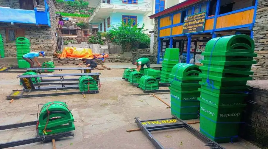
The conservation area is home to local communities, wildlife, monasteries and fragile mountain ecosystems. A few simple habits help protect both the environment and local culture.
| Do | Don’t |
| Carry a reusable water bottle | Litter or leave waste behind |
| Pack out everything you bring in | Disturb or approach wildlife |
| Stay on designated trails | Remove plants, flowers or herbs |
| Use refill stations where available | Waste water |
| Remove shoes before entering monasteries | Touch religious objects without permission |
| Walk clockwise around mani walls and prayer wheels | Step over or climb on mani walls |
| Ask before photographing people | Photograph people without permission |
| Dress respectfully near religious sites | Raise your voice near monasteries or sacred places |
| Support local teahouses, guides and porters | Bargain aggressively over small amounts |
| Keep noise low and respect local routines | Disturb livestock or local activities |
| Carry reusable toiletries, avoid extra packaging | Leave batteries or other waste behind |
Travel light, respect local customs and leave the area as you found it.
Quick Answers
1) How long is the drive to the Manaslu Circuit Trek start?
About 7 to 9 hours from Kathmandu by jeep or bus, via Dhading and Arughat.
2) Can I trek Manaslu solo?
Since 22 March 2026, a single trekker can apply for the RAP, but a licensed guide and a registered agency are still required.
3) Which permits do I need?
Manaslu RAP and MCAP, plus the Chumnubri Rural Municipality fee and Tsum Valley RAP if your route includes them.
4) Are there flights to Manaslu?
No regular flights. Charter helicopters can reach Samagaun and Samdo, weather permitting.
5) When is the best time?
Autumn (Sept–Nov) and spring (Mar–May).
6) Manaslu or Annapurna?
Manaslu for quiet and culture; Annapurna for infrastructure and easier access.
Why the Manaslu Conservation Area Matters
The Manaslu Conservation Area protects a rare combination of mountains, forests, wildlife and biodiversity. It also safeguards the cultural heritage of the communities who live inside it. Conservation here works because local people are part of it, taking an active role in natural resource management, conservation awareness and community development.
For anyone planning the Manaslu Circuit Trek, this changes how you should think about the trip. Manaslu is not just a trekking destination. It is a living conservation area where people, wildlife and nature share the same landscape, and the choices trekkers make can affect both the environment and the families who depend on it.
Whether you are walking the Manaslu Circuit, detouring into Tsum Valley or visiting the region’s remote villages, there is a lot to take in. We ask every trekker to travel responsibly: take your time, respect local cultures and leave the conservation area as you found it.
FAQS of Manaslu Circuit Trek and Manaslu Conservation Area
1) What is the Manaslu Conservation Area?
It is a protected area in northern Gorkha District, Nepal, covering 1,663 sq. km. It protects Himalayan landscapes, wildlife, forests and local communities.
2) Where is it located?
In northern Gorkha District, Gandaki Province. It borders the Tibet Autonomous Region of China to the north and the Annapurna Conservation Area to the west.
3) When was it established?
On 28 December 1998.
4) How large is it, and what is its elevation range?
It covers 1,663 sq. km, with elevations from roughly 600 m to 8,163 m.
5) Is it a national park?
No. It is a conservation area, managed through a community-based approach rather than as a national park.
6) Who manages MCAP, and what is MCAP?
The National Trust for Nature Conservation (NTNC) manages the area through the Manaslu Conservation Area Project (MCAP), which carries out conservation and community development work. Note that “MCAP” here means the project, not the permit.
7) What animals live in the Manaslu Conservation Area?
There are 39 mammal species, including snow leopard, red panda, musk deer, Himalayan tahr, blue sheep and Himalayan black bear, along with many bird and butterfly species.
8) Can you see snow leopards in Manaslu?
They live in the high-altitude parts of the area but are extremely elusive and rarely seen by trekkers.
9) Which treks pass through the conservation area?
The Manaslu Circuit Trek, Tsum Valley Trek, Rupina La Trek and Manaslu Base Camp Trek.
10) Is the Manaslu Circuit inside the conservation area?
Yes. It follows the Budhi Gandaki Valley through the conservation area before crossing Larkya La Pass.
11) Is Tsum Valley inside the conservation area?
Yes. It lies within Manaslu Conservation Area and is known for its distinctive Tibetan Buddhist culture and traditional mountain villages.
12) How do you get to the Manaslu Conservation Area?
Most trekkers travel by road from Kathmandu to Soti Khola or Machha Khola, then walk to Jagat, the main entrance to the conservation area.
13) Do I need a permit?
Yes. You need the MCAP entry permit, and depending on your route, additional restricted-area permits and local fees may apply.
14) Can I trek Manaslu independently?
Not completely. The restricted Manaslu routes require a licensed guide.
15) When is the best time to visit?
Spring (March to May) and autumn (September to November) generally offer the best trekking conditions and clearer mountain views.